23 Bartholomew's AA Road Maps


23 Bartholomew's AA Road Maps
26600
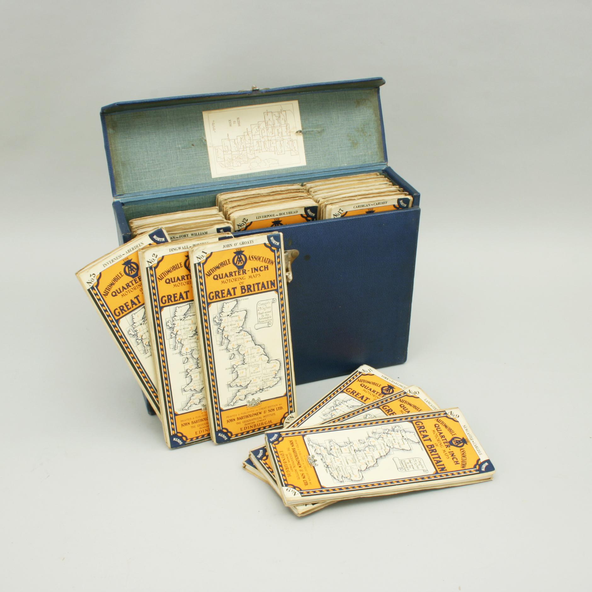
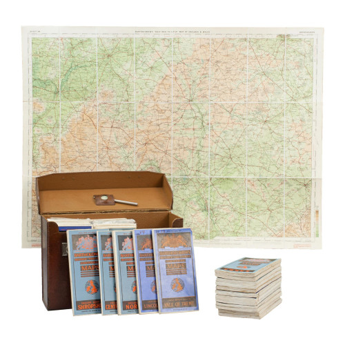
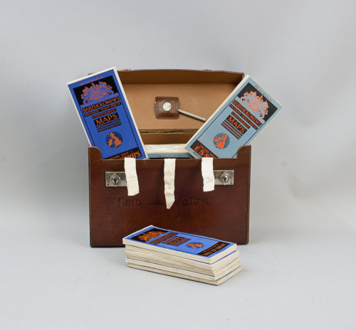
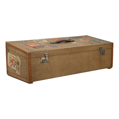
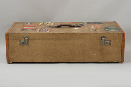
Vintage Set of Folding Bartholomew's AA Road Maps.
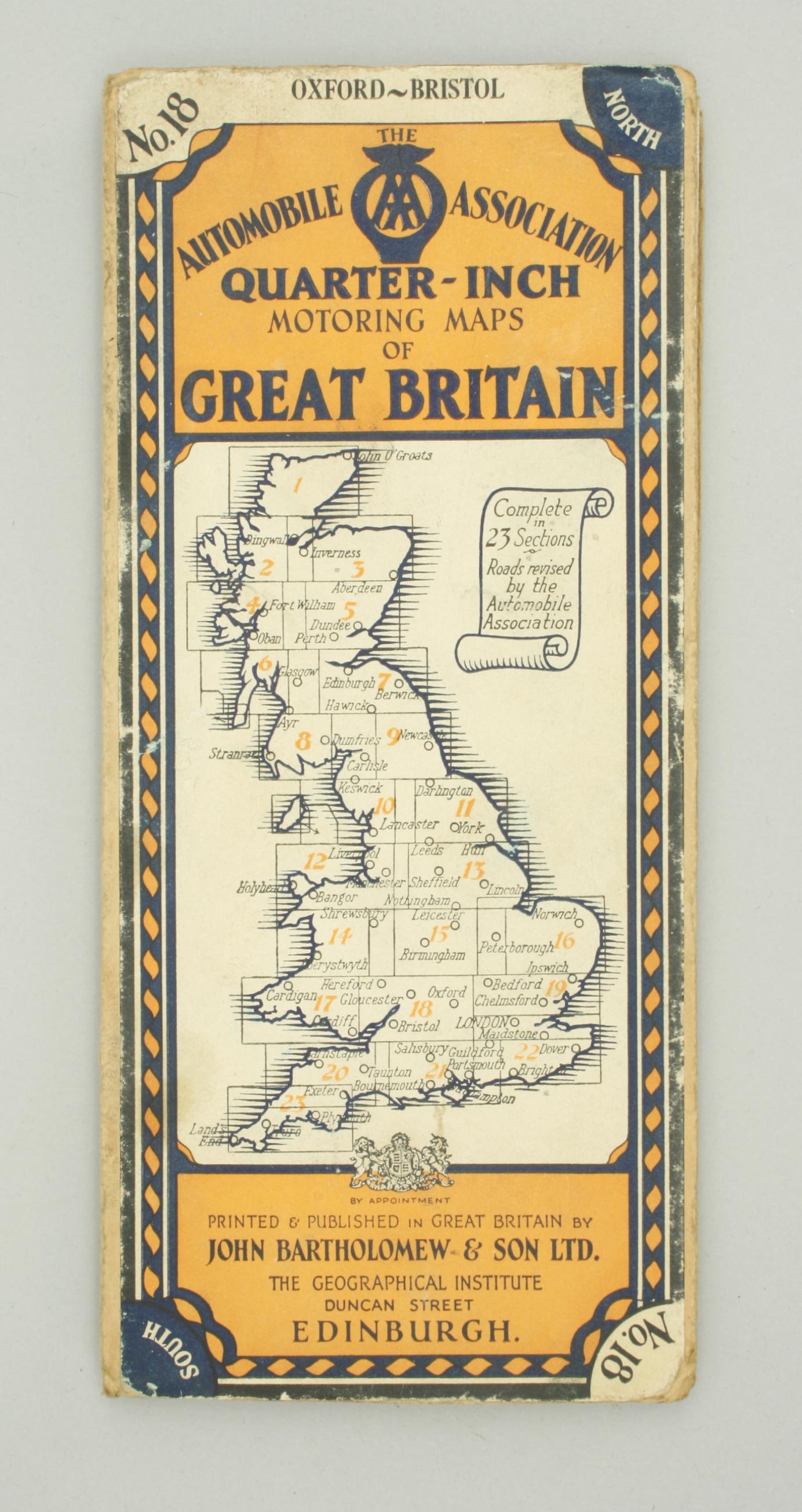
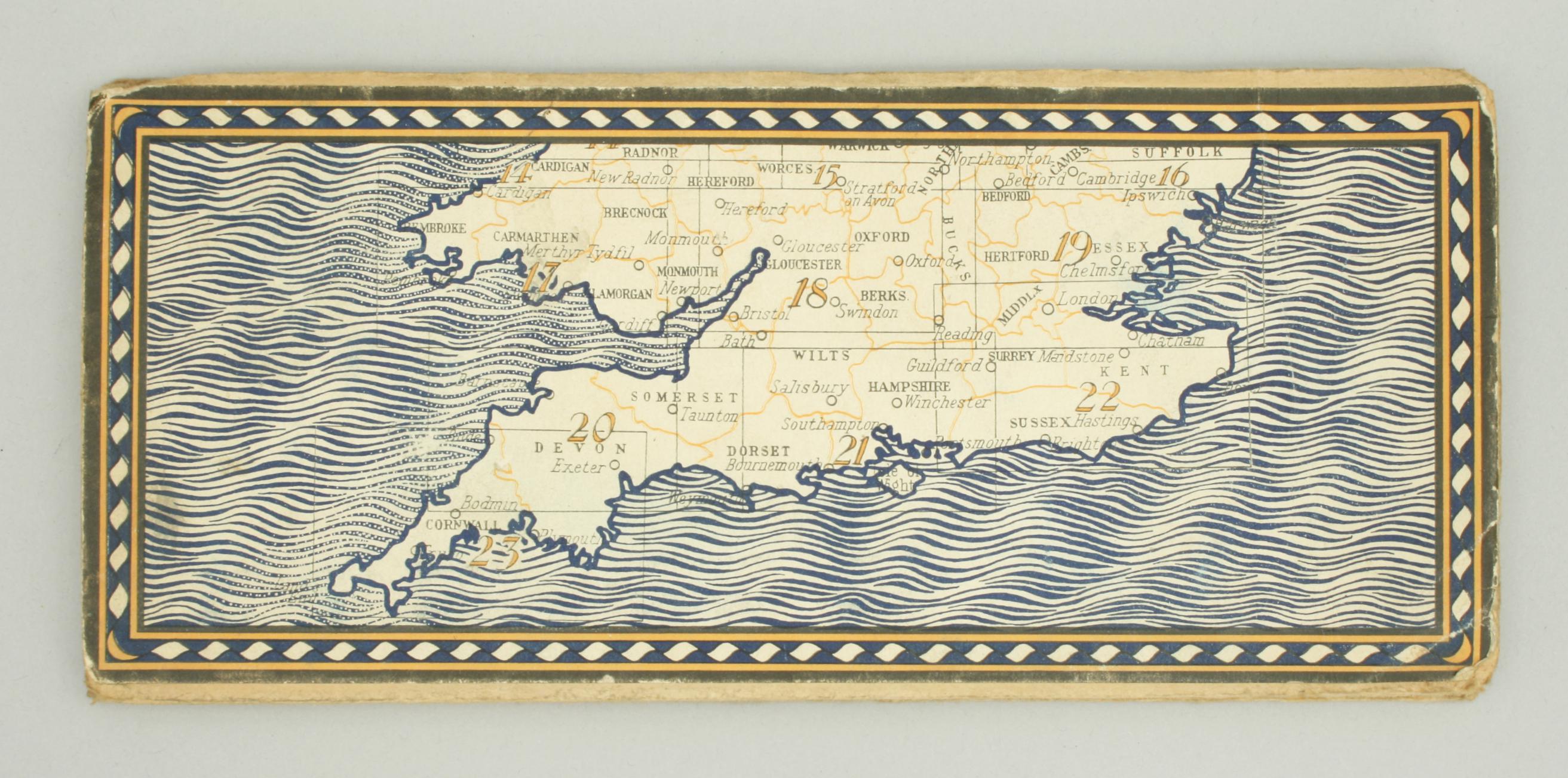
A set of 23 Bartholomew Automobile Association maps of Great Britain in a hard blue travel case. Each map has its own sheet number to the front with a label stating 'The Automobile Association, Quarter - Inch Motoring Maps of Great Britain'. There is also a map of the whole country on the lid which is divided into the map numbers to show how they correspond to each other. The covers also note that the maps are printed and published in Great Britain by John Bartholomew & Son Ltd., The Geographical Institute, Duncan Street, Edinburgh. The maps have a scale of 4 miles to an inch with the roads revised by The Automobile Association Jan. 1929. The set is complete with the case being in very good order with carry handle to the lid. The case embossed in gilt 'Bartholomew's Quarter-Inch Great Britain, Automobile Association (with AA logo).
Each map is made up of 16 printed pieces of paper mounted onto linen sheets and they measure 30 inches wide & 17 ½ inches high. The full set of 23 travelling folding AA maps comprises of:-
No.1 John O' Groats, No.2 Dingwall - Portree, No.3 Inverness - Aberdeen, No.4 Oban - Fort William, No.5 Perth - Dundee, No.6 Glasgow - Atr, No.7 Edinburgh - Berwick, No.8Dumfries - Stranraer, No.9 Newcastle - Carlisle, No.10 Lancaster - Keswick, No.11 York - Darlington, No. 12 Liverpool - Holyhead, No.13 Sheffield - Lincoln, N0.14 Aberystwyth - Shrewsbury, No.15 Birmingham - Leicester, No.16 Peterborough - Norwich, No.17 Cardigan - Cardiff, No.18 Oxford - Bristol, No.19London Northwards, No.20Exeter - Barnstaple, No.21 Portsmouth - Salisbury, No.22 London Southwards and No.23 Plymouth - Land's End.
Dimensions:
1900-1949
C. 1930
United Kingdom
Very Good.
RELATED ITEMS


.Each map is made up of 16 printed pieces of paper mounted onto linen sheets and they measure 30 inches wide & 17 ½ inches high. The full set of 23 travelling folding AA maps comprises of:-No.1 John O' Groats, No.2 Dingwall - Portree, No.3 Inverness - Aberdeen, No.4 Oban - Fort William, No.5 Perth - Dundee, No.6 Glasgow - Atr, No.7 Edinburgh - Berwick, No.8Dumfries - Stranraer, No.9 Newcastle - Carlisle, No.10 Lancaster - Keswick, No.11 York - Darlington, No. 12 Liverpool - Holyhead, No.13 Sheffield - Lincoln, N0.14 Aberystwyth - Shrewsbury, No.15 Birmingham - Leicester, No.16 Peterborough - Norwich, No.17 Cardigan - Cardiff, No.18 Oxford - Bristol, No.19London Northwards, No.20Exeter - Barnstaple, No.21 Portsmouth - Salisbury, No.22 London Southwards and No.23 Plymouth - Land's End.)